Twittens of Selsey

Every area has it's alleyways and footpaths, prehaps only known to the locals. Within Sussex, these alleyways are known as "Twittens", an area that runs ’betwixt’ and ‘between’.
Here is a list of some of these - if we have left any out please contact us to let us know!
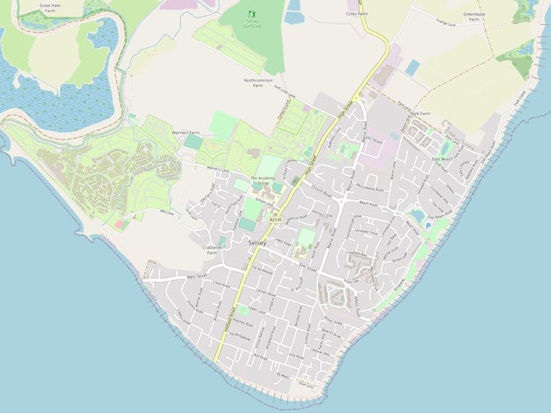
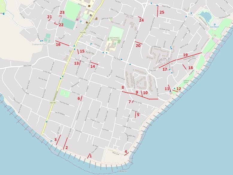
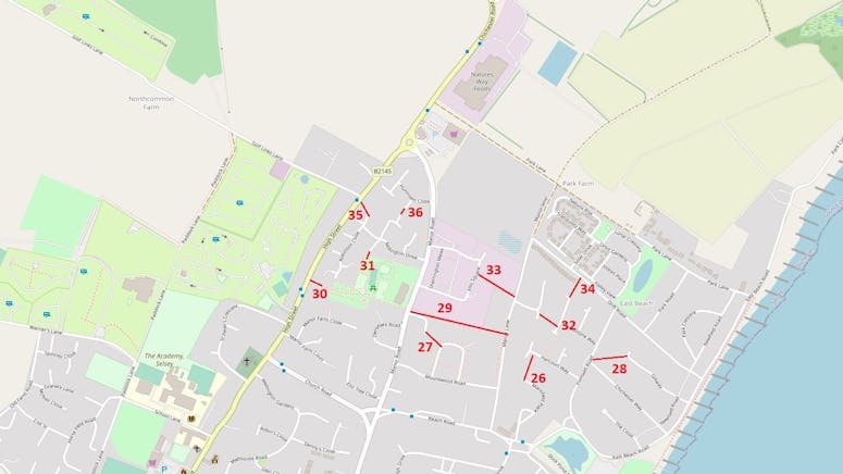
Please note that all map placements are approximate.

- The southern end of Solent Way onto the beach
- Between Ursula Square and the beach
- Seal Square onto the beach
- The eastward end of Oval Lane, between Oval Field and the beach
- Between Jones Square and Beacon Drive
- West Ursula Avenue and Green Lane
- Between Lawrence Close and James Street
- From Grafton Road to James Street
- James Street to Albion Road
- Cut away from the James Street to Albion Road alley into Sunnymead Drive
- Between Burlington Gardens and Kingsway
- From Kingsway onto the sea defence
- Between Langton Close and The Bridleway
- Linking Croft Road and St. Itha Close
- Elm Grove though to the High Street via the Co-Op
- Between the High Street and Paddock Lane - known as The Croat
- Linking Merryfield Drive, passing Pinks Row, onto East Street
- Between Fraser Close and Beverly Close
- Merryfield Drive to Marine Drive and on along Fisherman's Walk and onto Kingsway
- Linking Manor Road and Gainsborough Drive
- Between The Horseshoe and Horsefield Road
- Paddock Lane onto Horsefield Road
- Linking Paddock Lane and Saddle Lane
- Between Denny's Close and Manor Road
- Beach Road onto Gainsborough Drive


26. Linking Harcourt Way and Marisfield Place
27. Between Broomfield Road and St. Georges Close
28. Fontwell Road onto Gill Way
29. Linking Manor Road and Manor Lane
30. Chichester Road, opposite the old Police Station, into Manor Green Park
31. Linking Manor Green Park with Millington Drive
32. Between Roundstone Way and Wheatfield Road
33. From Ellis Square onto Manor Lane
34. Linking Roundstone Way and Drift Road
35. From Chichester Road, near Golf Links Lane, onto Robinson Close
36. Linking Petts Close and Harding Close